
Contour Mapping

Contour Mapping
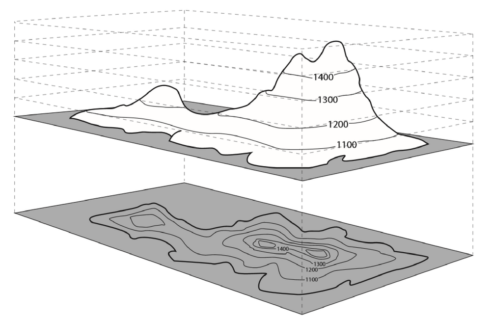
Contour mapping is the delineation of any property in map form by constructing lines of equal values of that property from available data points. Earth's surface has many different kinds of landforms that vary in height and elevation. Contour maps show the elevations of these surface features, which allows you to look at a two-dimensional map to visualize the Earth in three dimensions.