
American-built.
Business-ready.
The SkyScout 2+ is a professional UAV platform for construction, surveying, utilities, agriculture, public safety and organizations that need dependable aerial data.
Made in Batesville, Mississippi.
The SkyScout 2+ is American-designed, engineered and manufactured. It gives businesses and public-sector teams a capable American-made platform for professional drone operations.
Not one industry. Whatever your mission demands.
The SkyScout 2+ is not limited to public safety. Alpha Eagle Technology configures the aircraft and payload around the work your business performs—from construction documentation and surveying to infrastructure inspection, agriculture, mapping and emergency response.
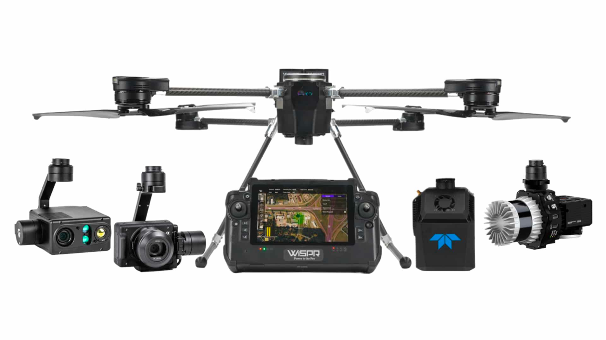
Compact capability without compromise.
Portable Design
A field-ready multirotor platform designed for efficient transport, deployment and operation.
Long-Range Communications
Mission-focused command and control designed to support demanding operational environments.
Advanced ISR Payloads
Configure the aircraft for visual intelligence, thermal work, mapping, LiDAR or agriculture.
Secure & Reliable
An NDAA-compliant platform built for organizations that require dependable professional performance.
One aircraft. Multiple payload paths.
Photogrammetry
High-accuracy surveying, corridor mapping, construction measurements, digital twins and 3D modeling with supported Sony, WISPR and Gremsy camera options.
Thermal + Visual
Radiometric thermal data, detailed visual imagery and laser-ranging options for utilities, infrastructure, public safety and industrial inspection.
LiDAR
Supported YellowScan, RESEPI and partner integrations for topographic surveying, vegetation mapping, transmission-line work and dense data collection.
Multispectral
MicaSense and Agrowing sensor ecosystems support crop-health analysis, nutrient management, irrigation assessment and yield optimization.
Put actionable aerial data to work.
Professional performance in a portable platform.
Payload selection affects mission performance. Alpha Eagle Technology can help configure the right aircraft, sensor and workflow for your operational requirements.
Let’s build the right UAV package for your mission.
Talk with Alpha Eagle Technology about aircraft, payload, software and support options.